Ask most people in Corinth where to hike on a Saturday morning and they will say Spruce Mountain, then mention the fire tower, then tell you about the view. Ask them if they have been up there recently and the answer gets vaguer. The tower has not been climbable for a while now. The Department of Environmental Conservation flagged it for structural concerns, and the view that made the hike worth the 2.5 miles is currently out of reach.
Here is the part almost nobody mentions. Just 0.2 miles down Wells Road from the Route 9N intersection sits the entrance to a 127-acre preserve that did not exist before last October. It has its own brook, its own stand of red oak and hemlock, and three trails that nobody has to climb a condemned tower to enjoy. Most Corinth residents drive past the turnoff without knowing it is there.
What's Actually Wrong at the Top of Spruce Mountain
The Spruce Mountain Trail has been the town's default hike for years, and for good reason. It is a moderate-to-difficult 2.5-mile route through old growth and recovering forest, built through a partnership between the DEC, Saratoga County, and Saratoga PLAN, leading to a 73-foot fire tower that was fully restored in September 2015. On a clear day, the top delivers views stretching past the Hudson River into the Green Mountains of Vermont.
That last part is the problem right now. Saratoga PLAN's own trail page carries a direct reminder from the DEC that the fire tower itself is closed due to structural concerns. The trail is still open. The summit is still reachable. The reason most people made the drive in the first place is not currently available.
That does not make Spruce Mountain a bad hike. It makes it a different hike than the one everyone remembers, and it means the trail's usual pull has weakened at exactly the moment a new option opened less than a mile away on the same road.
The Same Road, Just Down from Route 9N
Corinth residents already know Wells Road as the way to Spruce Mountain. Coming from the village, you head south on Route 9N for 2.7 miles, then turn right onto Wells Road. From there it is a few more miles to a T intersection, a right onto the unsigned Spruce Mountain Road, and a dead end at the trailhead.
What changed last fall is what sits on Wells Road before that turn. The trailhead for the new Curtis Preserve is on the right, just beyond the Route 9N intersection. If you have driven to Spruce Mountain any time since October, you have already passed it.
That proximity matters more than it sounds like it should. A new preserve announced by a land trust two towns over is easy to ignore. A new preserve on the exact road residents already use for their most familiar hike is a different kind of local fact, one that changes what "going for a hike in Corinth" can mean without changing anyone's drive time.
How 127 Acres Came to Belong to Everyone
The preserve exists because of a friendship that outlasted the people who started it. In 1986, Patricia LeClair and her husband bought nine acres in the Town of Corinth from their neighbors, Jack and Mary Curtis. Jack had been an old friend of Patricia's husband, and over the years Patricia and Mary grew close, walking together in the woods that spread across both properties. After the Curtises passed away, their land came to the LeClair family. Patricia later decided to donate 127.5 acres of it to Saratoga PLAN, the regional land trust that has now conserved more than 14,000 acres across Saratoga County.
"I walked those woods for many years and I hope that people will enjoy them as much as I did."
That is Patricia LeClair, quoted in Saratoga Today's report on the ribbon-cutting ceremony on October 23, which drew more than 30 people, including her daughters Pam and Tari, Senator James Tedisco, Assemblyman Matt Simpson, and Town of Corinth Supervisor Eric Butler. The event was co-hosted by Saratoga PLAN and the Saratoga County Chamber of Commerce.
The preserve's boundary is not incidental either. Its northern edge follows the historic Blue Line, the surveyed boundary that defines the Adirondack Park. Corinth has always described itself as sitting at the foothills of the Adirondacks. Now there is a specific, walkable piece of the town where that description is literally the property line.
Getting the land protected took more than a gift deed. The Saratoga County Trails & Open Space Committee's Farmland Protection and Open Space Grant Program contributed $32,900 to cover transactional costs, and the Nature Conservancy's Climate Resilience Grant Program added another $25,000 toward future stewardship. Volunteers, including employees from Regeneron during the company's Day for Doing Good program, helped PLAN staff build and mark the trails.
What's Actually Out There
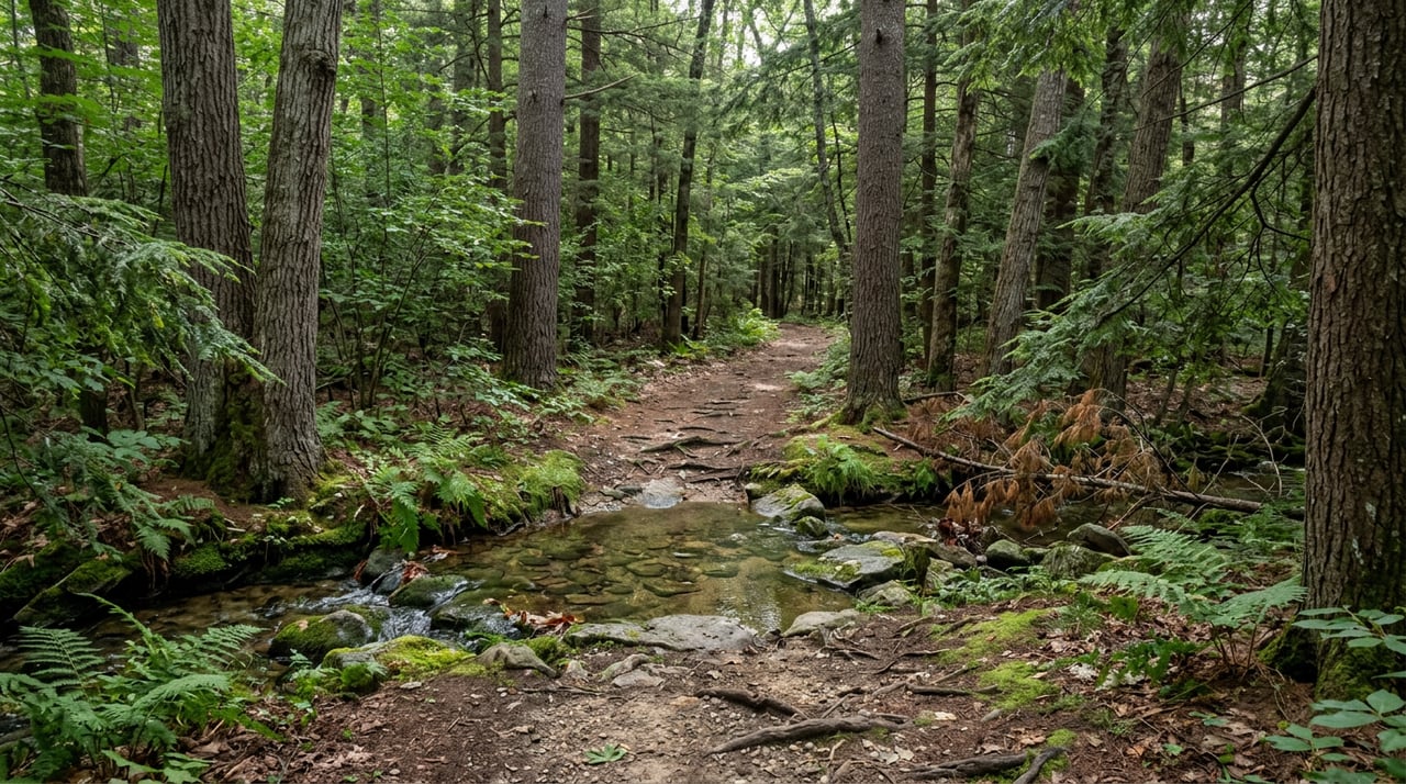
The Curtis Preserve is not trying to replicate Spruce Mountain's drama. There is no summit, no tower, no hundred-mile view. What it offers instead is about 1.7 miles of trail across three routes, winding through a mixed forest of red oak, white pine, and eastern hemlock, following a brook the whole way. Saratoga PLAN describes the land as critical wildlife habitat and an important link for regional wildlife connectivity, language that matters less for the hike itself than for what it signals about why the land was worth protecting rather than developing.
The preserve is open to the public from dawn to dusk, and it is licensed for more than walking. Snowshoeing, horseback riding, and cross-country skiing are all permitted uses, a detail that matters for the horse owners scattered through Corinth's outskirts who are usually stuck trailering somewhere else to ride.
Making a Day of It
None of this requires treating Corinth like a destination. It is a town where people already have routines, and the interesting thing about the Curtis Preserve is how easily it slots into an existing one rather than demanding a new plan.
A short walk through the preserve in the morning, before the heat sets in, pairs naturally with an afternoon at Pagenstetcher Park, the public beach and boat launch that the town and village of Corinth cooperatively operate on the lower Hudson. It is the kind of low-key, unglamorous amenity that does not show up in visitor guides but gets used constantly by people who live within a few miles of it.
Evenings have their own options. The Corinth Barn on Mallery Street has kept its summer concert calendar going, with Cedar Ridge playing there earlier this month on August 1. It is a small venue by design, and it is the kind of place where a two-hour drive from anywhere else in the Capital Region would be silly, but a ten-minute drive from home makes complete sense.
None of these things are new discoveries requiring a special trip. They are Tuesday-evening and Saturday-morning options that got a little richer this year, whether or not most people have noticed yet.
The Map Changed. Habits Are Slower.
Towns do not usually get 127 new acres of permanently protected land in a single year, and Corinth did not ask for this one so much as receive it, through a gift shaped by one woman's decades-long friendship with her neighbor. That is a better story than most land acquisitions get, and it deserves more attention locally than a quiet trailhead sign on Wells Road is likely to generate on its own.
Habits change slower than maps do. The next time Spruce Mountain feels like the only option, or the tower closure makes the familiar hike feel like it is missing its point, the turnoff worth remembering is the one that comes first.
If you are weighing what a property near land like this is actually worth, or thinking about what proximity to a permanently protected preserve means for a home in Corinth or the wider Saratoga region, Horse & Home Estates can walk you through it with the same attention to place that shaped this piece of ground. Request a concierge consultation when you are ready to talk specifics.
This article is general information, not legal, tax or financial advice. Consult a qualified professional about your situation.